Plan.Explore.Enjoy.
The outdoor app that helps you prepare every outing.
Who is it for?
An app built for every one of your adventures
Whether you head out for a weekend walk, live for the mountains, or share a territory of your own: Compath adapts to what you need.
Outdoor enthusiasts
Find your next outing, follow the trace and share your runs.
See the featuresMountain pros
Slope angles to the degree, live avalanche bulletins, regulated zones: the precision you need.
Explore ProTourism pros
Publish your routes, track your audience and reach committed practitioners.
Become a partner- Official, verified dataIGN, Météo-France, BERA, official partners
- Works offlineMaps and routes available with no signal
- Thousands of routesBuilt by the community and our partners
- Your data protectedPrivacy and security at the heart of Compath
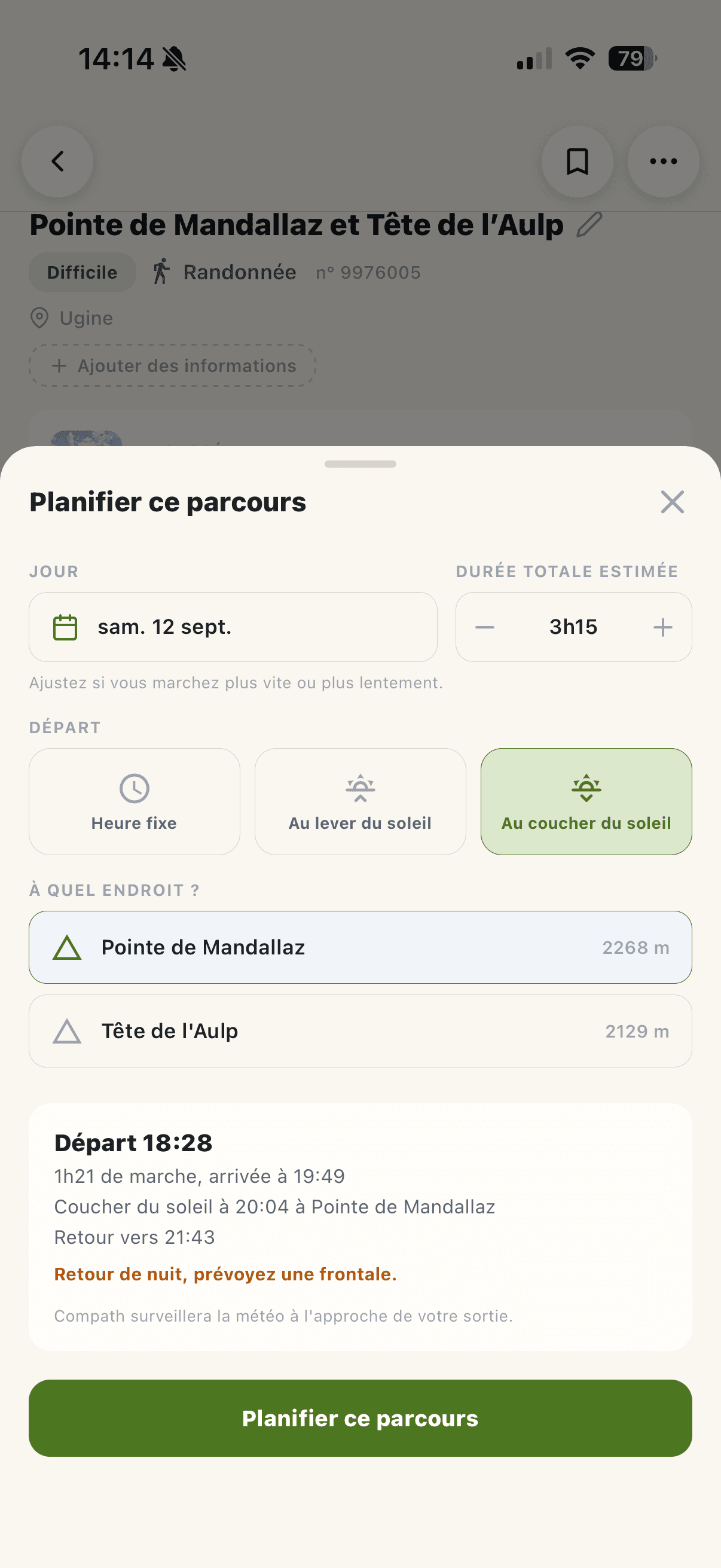
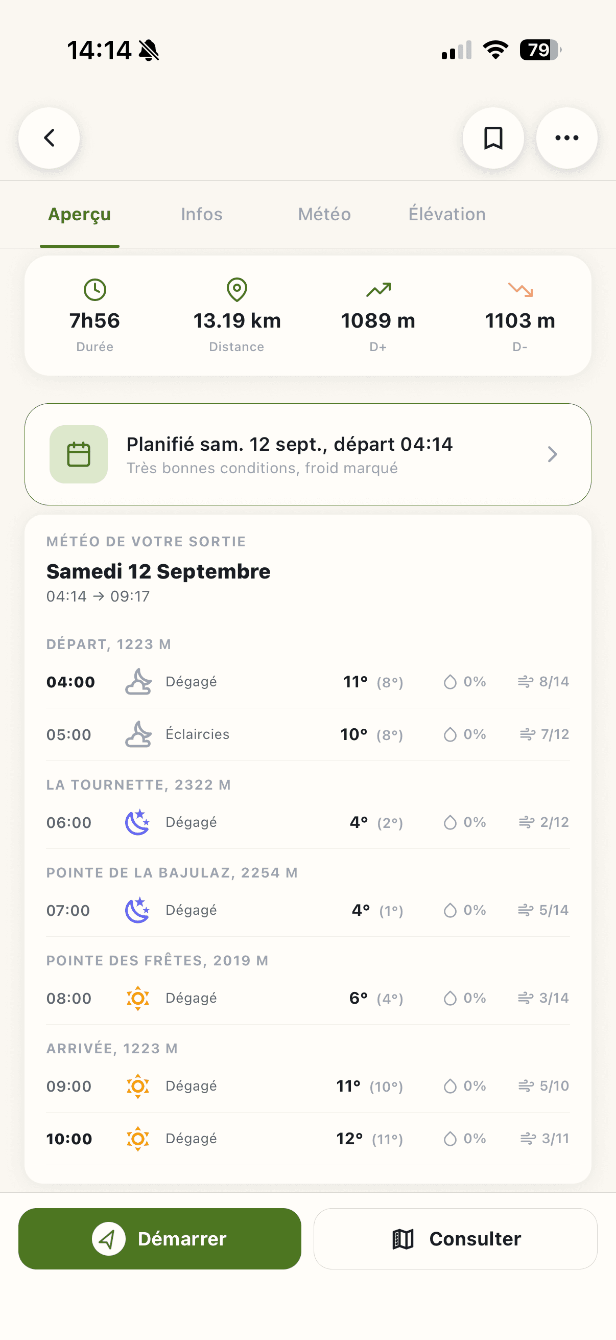
Plan your outing
Set off at the right time, in the best conditions.
Compath reads the weather all along your route and follows how it changes until you leave. Rain, wind, storms, temperatures: you know what to expect, in the right place at the right time.
Set your goal. Compath works out the rest.
A start at dawn, an arrival at sunset, or a summit at a precise hour: set your goal and Compath estimates your schedule, your return time and any stretch that falls after dark.
The weather where you'll actually be.
At the trailhead, on the ridge, at the summit or at the hut: conditions are worked out from your position and its elevation. Because the weather at the car park does not always say what waits 1,500 metres higher.
Your outing stays under watch.
Forecasts move. Compath watches your outing until you leave and speaks up only when something changes: conditions turning, a storm risk, or a better weather window nearby.
If tomorrow is better than today, you'll know.
Set off knowing
Everything worth knowing, on one map
Weather, snow, water status, air quality, restrictions, protected areas and more. Compath stacks every layer over the exact spot you mean to go, and tells you what is waiting there.
See all the data- Weather & rain radar
- Snow cover
- Water status by massif
- Avalanche bulletin (BERA)
- Fire danger
- Slope & relief
- Dated satellite imagery
- Protected areas
- Sport restrictions
- Livestock guardian dogs
- Drone zones
- Air quality & pollen
- UV index
See it before you go
Fly your route before you set off
Fly the track in relief, over satellite or IGN mapping, and read the real gradient, the exposed sections and the scenery waiting for you. Then export the flyover as a video to share.
- 3D view
- 3D video
- Satellite
- IGN
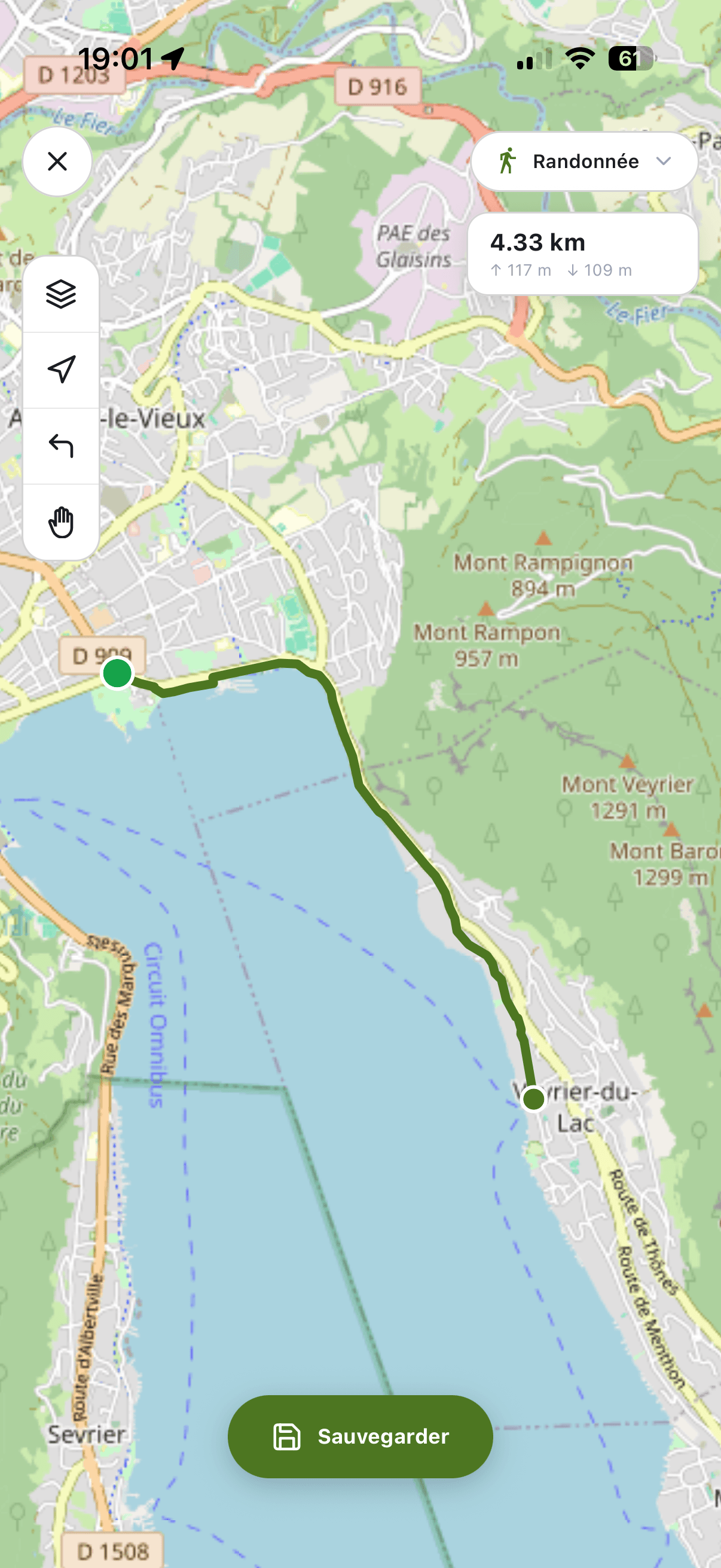
Draw & generate
The route that doesn't exist yet
Same old loop again? Draw your own in a few taps, or let Compath invent it for you.
A line that follows the trails
Drop two points on the map and the track snaps to the paths that are actually there. Routing follows your discipline (hiking, trail, MTB, road) and distance and elevation update with every tap. Off-trail, manual mode takes over.
A loop made to measure, in one tap
Just name your activity and how many kilometres you want: Compath composes a route around you, looping back or not. Not inspired? Run it again: every try offers something else.

Ready to go?
Compath is free. Get the app on iOS or Android and head out.
Partners
They work with us

Météo-France
Météo-France provides Compath with official, up-to-date information on weather conditions, forest-fire risk and avalanche risk bulletins (BERA), so you can plan your outings safely.

Biodiv'Sports
Biodiv'Sports identifies areas where certain sports are temporarily or permanently regulated to protect wildlife, flora and sensitive natural habitats.

LPO, Ligue pour la Protection des Oiseaux
The LPO helps protect sensitive natural areas by providing information on biodiversity-preservation zones and areas restricted to protect fragile species.

Suricate
Suricate is France's national platform for reporting problems on trails and outdoor routes. Through this partnership, Compath users can easily view and submit reports about route conditions.

IGN
The IGN provides its reference base maps, renowned for their accuracy and wealth of detail, enabling reliable navigation across France.

Géoportail
Géoportail enriches Compath with advanced geographic data such as slope maps and drone-regulated zones, for a better understanding of the terrain and its regulatory environment.